Future Of Photogrammetry
How Banking, Mining, Agriculture, Defense, City Planning, etc would use Photogrammetry to make better informed decisions !!
Future Of Photogrammetry
12/11/22
If you are new, here’s what Product Analytica is all about.
This edition of Product Analytica will focus on Photogrammetry Sector and various practical usecases of the same. We understand Photogrammetry from the very basics and try to predict the future of this sector. We also look at some startups working in this sector and also discuss opportunities for startup founders !
We have previously analysed sectors like E-Commerce, Business Models with PayTM and Amazon, Marketing with Burger King and Fevicol and also Products with Zomato. We even have built a framework for Venture Capital to help founders and early VCs.
Let’s get started 🚀
But First, What is Photogrammetry?
It is a process of obtaining information about physical objects through recording, measuring, and interpreting imagery (📷) and digital representations of energy patterns (⚡) derived from noncontact sensor systems (🛸).
Let’s understand this with an example:
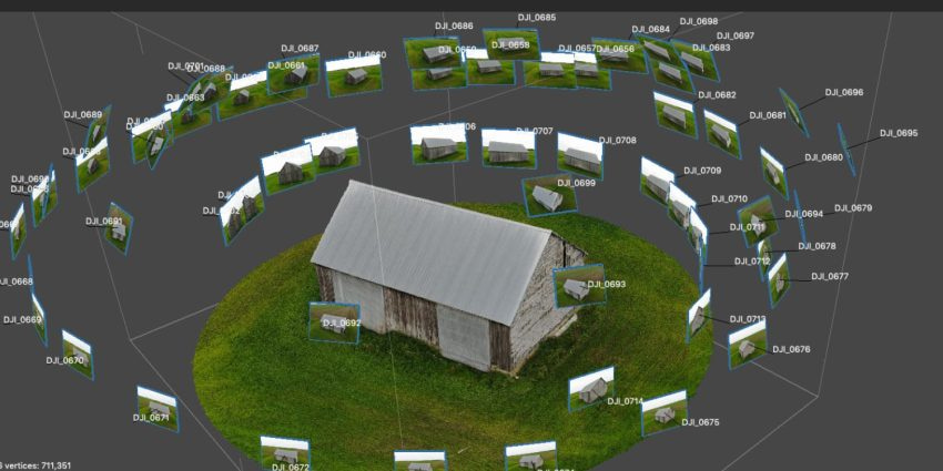
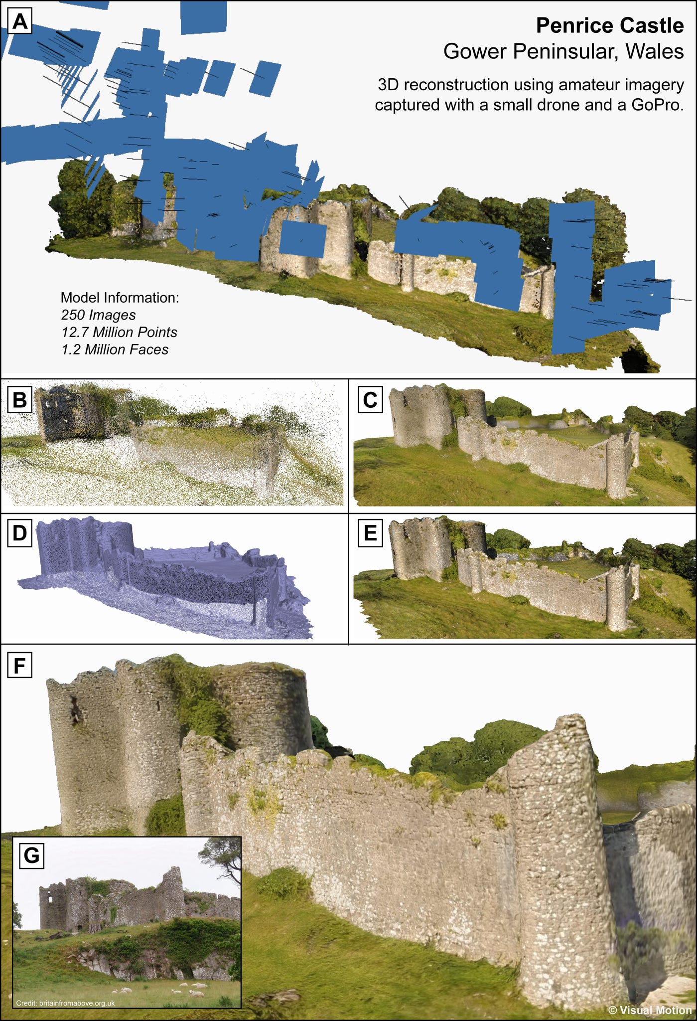
Say you want to take a 3 Dimensional Photo of your house 🏠, you take multiple photos 📷 of your house from all angles, then you use software that processes all the 2 Dimensional images via Big Data Analytics and Machine Learning to provide you with a 3D model of your house 🕶️. This whole process is termed Photogrammetry.
For all the geeks out there, I have explained this in a diagrammatic representation: Link
Using different types of cameras and different spectrums of waves, multiple interesting use cases are achieved.
Let’s understand each step in detail and identify opportunities in each step:
Taking multiple photos of an area
Photos can be taken from land (terrestrial) or air (aerial)
Terrestrial photogrammetry dealing with object distances up to ca. 200 m is also termed close-range photogrammetry.
Ariel photogrammetry has two types: Vertical Photography and Oblique Photography.
Small-format aerial photogrammetry in a way takes place between these two types, combining the aerial vantage point with close object distances and high image detail.
Aerial photogrammetry ✈️ requires the use of vertical aerial photographs (those where the axis of the camera was no more than 3° from vertical) and most often requires the use of stereo pairs (overlapping photos)
SLR cameras and their recent mirror-free equivalents must be considered more suitable for small-format aerial photogrammetry than compact cameras.
SLR cameras are getting cheaper and smaller but still are costly and heavy. Compact cameras have the problem of high prices and slow shutter speeds and frame rates.
A D2C play in this area for selling cameras and drones is an attractive model 🤑.
Even financing and pay-as-you-use models for various aerial altitudes can achieve good success here 🔥.
Using sensors to get reliable data
Visible light waves in the electromagnetic spectrum are generally used.
Near-infrared waves have also seen great applications.
R&D is required to find applications with unique wavelengths 🔬.
Georegistration of the photo📍:
This is done when getting the photos itself.
Data from Laser scanning, mobile mapping, geo-located, sensors, geo-tagged web contents, volunteer geographic information, and simulations are used for the same.
Data-Driven Startups which provide reliable ✨data-on-demand✨ can achieve scale.
Processing of the data🖥️:
Multiple photos need to be stitched together and errors due to distortion, displacement, and tilt need to be removed.
Orthomosaicking composites aerial images into a single, seamless, geometrically corrected image.
Stereo compilers allow us to correct a large portion of the inherent error from sources of distortion and displacement.
Structure-from-motion photogrammetry to align aerial images, stitch them together into a larger, seamless image
This data needs to be stored in a proper format for analysis. In climate science, NetCDF/HDF is one of the most commonly used data structures, which consists of multidimensional variables within their coordinate systems and some of their named auxiliary attributes.
For performing big data analysis on this data, MapReduce is not compatible with the data type and format, thus a spatiotemporal indexing approach is used.
SAAS Startups which process photos and provide a 3D model with analysis is a good B2B models. This is a crowded market and the moat is an important factor.
Machine Learning
After we get all the photos, we need advanced machine-learning techniques to identify specifications from the photo/ 3D Model.
These may include measuring height, finding buildings in the area, identifying a specific tree variety, etc.
Machine Learning is also required to make the photos sharper and reduce errors👨💻.
Patents on these algorithms will ensure the long-term moat of a 💸SAAS startup💸.
GIS:
Startups that analyze multiple map-based data points for consulting and analysis can flourish💰.
The application for banking, mining, agriculture, etc are multiple, and consulting and analysis of all photos and models will be critical🤑.
Let’s understand some applications:
Applications include the measuring of coordinates; the quantification of distances, heights, areas, and volumes; the preparation of topographic maps; and the generation of digital elevation models and orthophotographs.
Maps🗺️: Photogrammetry produces highly accurate maps, especially useful in toxic/ unmanned environments.
Natural resource management🏞️: Their application ranges from private companies counting the number of trees harvested in a plantation, to a government conducting a detailed carbon inventory of their forests.
Climate❄️: Satellite oceanography, Deforestation, Forest Fire, investigation of water resources, and analysis of thermal patterns, earthquakes, floods, and eruptions.
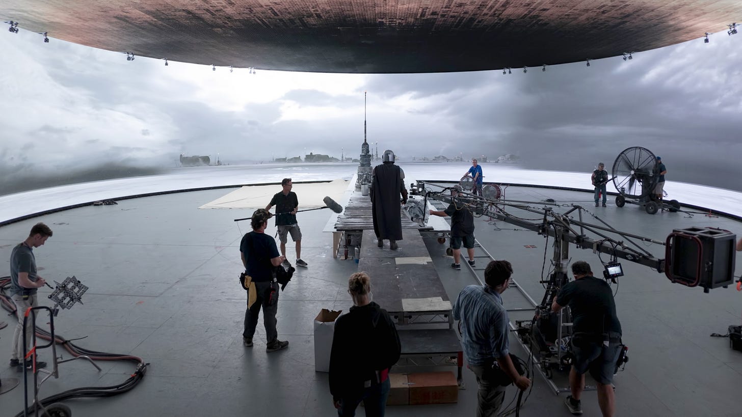
CGI movies and games🍿: 3D models of cities, objects, and planets. Essential in Metaverse and AR
Planning of cities and highways🏙️: New highway locations, detailed design of construction contracts, planning of civic improvements.
Visualization and Simulation: An example is a flight simulator or city visualization or UAV visualization or Nighttime simulation or drone delivery simulator.
Exploration: To identify and zero down to areas for various exploratory jobs such as oil or mining or exploration.
Mars Exploration: Moon shot but interesting.
Agriculture🌱: Soil type, soil conservation, crop planting, crop diseases, crop acreage.
Defense🪖: Understanding own territory, enemy territory, and camps.
Evolution and Future:
Since its development approximately 150 years ago, photogrammetry has moved from a purely analog, optical-mechanical technique to analytical methods based on computer-aided solutions of mathematical algorithms and finally to digital or softcopy photogrammetry based on digital imagery and computer vision, which is devoid of any optomechanical hardware
As we move forward, Photogrammetry will play a key role in analysis and prediction. The shift from exploration to prediction will take place. This shift will be powered by startups that use unique cameras and sensors with powerful machine-learning models.
Players in India:
Urban planning, geospatial services, data integration and management, geological services, data solutions, etc.
Geospatial services, environment, and spatial planning, disaster and climate risk reduction.
GIS mapping and outsourcing for businesses to optimize and understand trends and patterns.
Drone as a Service provides aerial photography and engineering surveying solution.
Drone survey solution provider, providing end-to-end managed drone survey solutions for various sectors such as mining, agriculture, irrigation, insurance, and urban.
Issues with Photogrammetry:
Drones are difficult to land in rough terrain or have short battery life. The biggest barrier to utilizing drones in many countries is receiving the necessary permits or permissions to fly these vehicles in regulated airspace.
Also, issues include stereo coverage, navigability, and stableness of the drone.
Weather conditions (winds, clouds, haze, etc.) affect the aerial photography process and the quality of the images.
Seasonal conditions affect aerial photographs.
Hidden grounds caused by man-made objects, such as an overpass and a roof, cannot be mapped with photogrammetry.
The accuracy of the mapping depends on flight height and the accuracy of the field survey.
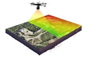
The popularity of Drone LiDar. LiDAR can collect information at a resolution of 1 m to up to 10 cm, and is detailed enough to see individual tree crowns and delineate tree species. LiDAR is suitable for small areas with more precision.
Conclusion:
As Data Collection becomes ubiquitous, Photogrammetry as a sector will definitely boom.
As Industries depend on more reliable analysis and prediction methodology, Photogrammetry as a sector will definitely boom.
As the metaverse and VR+AR become more real, Photogrammetry as a sector will definitely boom.
It would be awesome to see this sector grow multiple folds in the coming years !!
Thank you, for reading this newsletter, we are super grateful for your support and love.
We hope you become a great founder and an investor !!
Disclaimer: Any views or opinions represented in this newsletter are personal and do not represent those of people, institutions, or organizations that I may or may not be associated with in a professional or personal capacity unless explicitly stated. Any views or opinions are not intended to malign any religion, ethnic group, club, organization, company, or individual.


